
Map Trail colour yellow 🟡 7 Miles / 11 Km
Symbol: Fence posts, symbolising greater access to the countryside.
Dailly Trail starting points
Each trail route originates in the Village Square, at the Dailly Trails information board by the Church. What3words route start point ref ///nothing.exposes.balancing
Ready for a proper Scottish hill adventure?
The Maxwellston Hill Trail offers experienced walkers an exhilarating linear route that will test your stamina and reward you with some of the most breathtaking views in the district.
But be warned - this isn't your average countryside stroll!
Essential preparation
With Scotland's notorious weather changes, proper hill walking boots are essential - trainers simply won't cut it on these steep, rough paths.
The trail can become extremely muddy, especially where it passes through grazing land with cattle grids.
Pack waterproofs, warm layers, and always carry a map and compass.
When fog rolls in or the coastal haar (sea mist) descends, navigation skills become crucial. If you're not confident using a compass, consider joining a guided group or choosing one of our gentler trails.
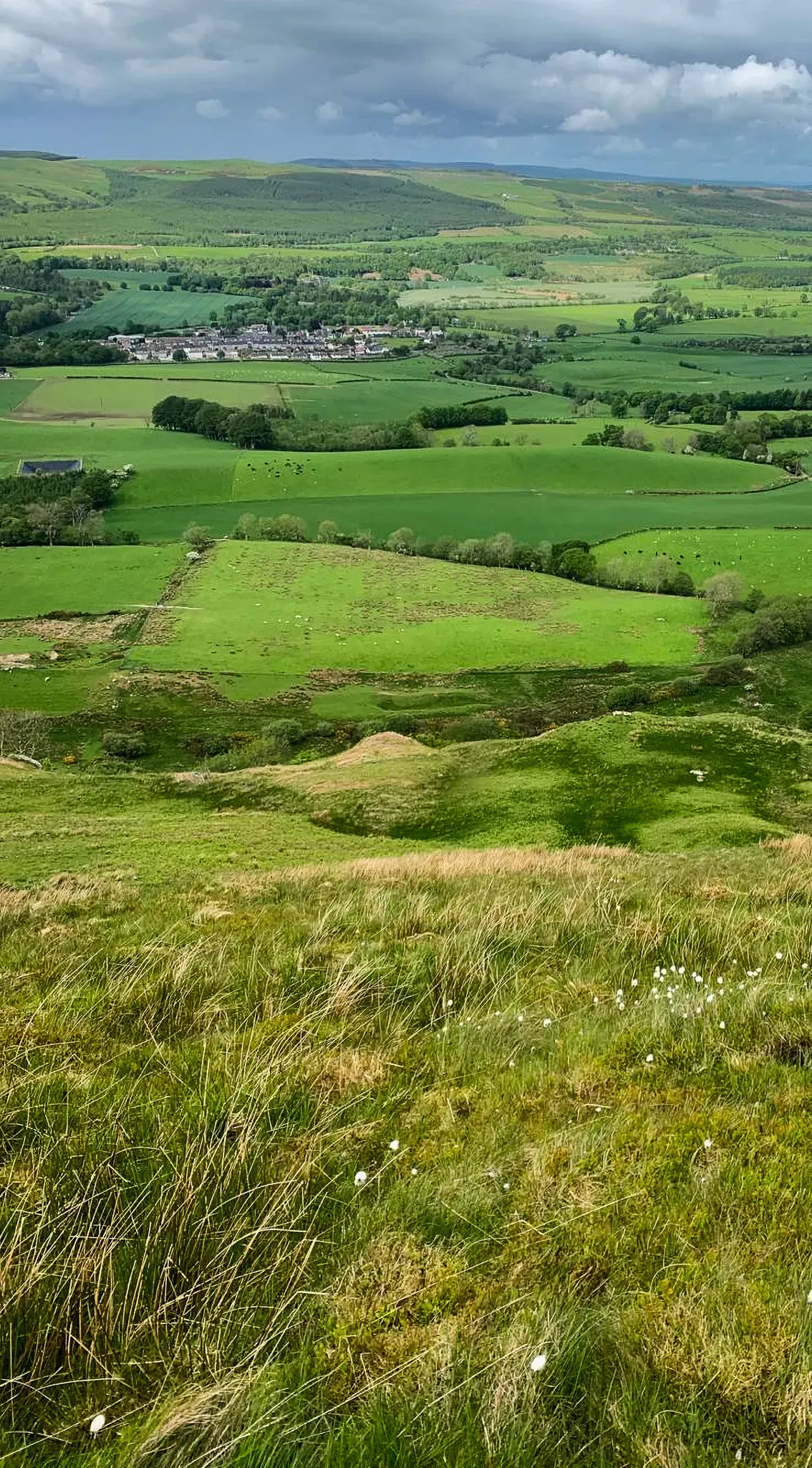
Setting Off Through the Valley
Setting off past the peaceful cemetery, you'll follow the clear waters of Lindsayston Burn.
The imposing silhouettes of Hadyard Hill and Maxwellston Hill create a dramatic backdrop along the southern edge of the Girvan Valley, a preview of the magnificent panoramas awaiting those who reach the top.
The Challenging Ascent
The climb up Hadyard's exposed shoulder is challenging but thrilling, with views expanding spectacularly with every hard-won meter of elevation.
Wildlife of the Moorland Plateau
Once you reach the wild moorland plateau, you've entered the domain of Scotland's most iconic wildlife - listen for the haunting call of curlews, watch for soaring buzzards, and if you're lucky, spot the lightning-fast hunting flights of peregrines, kestrels, and merlins.
Historic Fort and Robert Bruce's Legacy
With the village of Dailly and the Girvan Valley lying well below, the site of a prehistoric fort on the summit of Maxwellston Hill is reached.
The remains of the Pictish fortress, consisting of two earthen ramparts and two ditches, can be seen. This scheduled monument has associations with Robert the Bruce, who, having landed on the coast from Arran, took refuge here following an unsuccessful attack on Turnberry Castle. Bruce camped with some 300 men for three days before moving to a more secure location in the Galloway Hills.
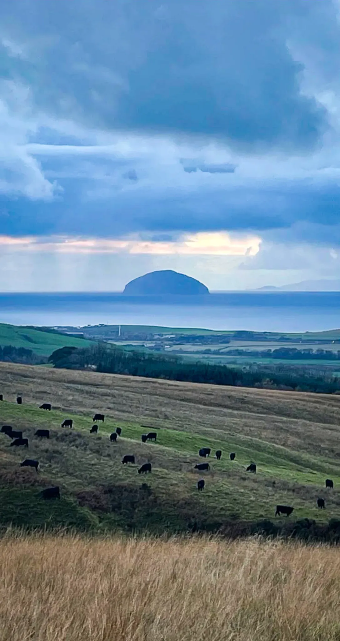
Summit Views and Return Journey
On a clear day, you can enjoy extensive views of the Ayrshire coast towards the Cumbraes and to the south, overlooking Penwhapple reservoir, the Southern Uplands stretch to the horizon. To the south, Hadyard Hill Windfarm is a prominent feature. Walkers then need to return along the same route.
Critical safety information
The weather can change rapidly.
What starts as sunshine can quickly become thick fog.
The plateau lacks distinct landmarks.
Waymarkers help, but compass skills are vital in poor visibility.
Steep, rough terrain throughout, not suitable for casual walkers.
Cattle graze these hills.
Gates must be closed, and dogs kept under strict control.
Always inform someone of your route and expected return time.
Trail essentials checklist
Quality hill walking boots (no exceptions!)
Waterproof jacket and trousers
Map, compass, and the knowledge to use them
Extra food and water
Warm layers - it's always colder on top
Mobile phone (though the signal can be patchy)
First aid basics
Is this trail for you?
Perfect for experienced hill walkers seeking a genuine challenge and photographers chasing those perfect Highland vistas. The panoramic views from the plateau are simply unforgettable. On clear days, you can see for miles across the Ayrshire countryside and out to sea.
Not recommended for:
Young children, inexperienced walkers, or anyone uncomfortable with steep climbs and potentially challenging weather conditions.
The Maxwellston Hill Trail delivers an authentic Scottish hill walking experience - challenging, potentially wild, but ultimately rewarding for those properly prepared.
Respect the hills, prepare thoroughly, and you'll be rewarded with memories (and views) to last a lifetime!
Other longer walks to consider
Lindsayston Walk Dailly
Barony Hill Trail Dailly
Scottish Outdoor Access Code
Please respect South Ayrshire’s countryside and the people who rely on it for their livelihood.
In Scotland, people have the right to access most land for outdoor recreation, provided they act responsibly. This is called Scottish access rights and differs from the laws in England and Wales. While enjoying outdoor activities, you must comply with the Scottish Outdoor Access Code.
Click the green button below to learn about your responsibilities before walking.
Remember, March to May is lambing time.
Ewes and lambs are very vulnerable at first. Mums can easily lose their babies if scared or disturbed by people or dogs. Lost lambs can die very quickly.
- Walk trails which do not go through fields of livestock at this time of the year.
- Take your litter home, or put it in a bin.
- Clear up your dog’s mess.
- Please follow the Scottish Outdoor Access Code at all times.